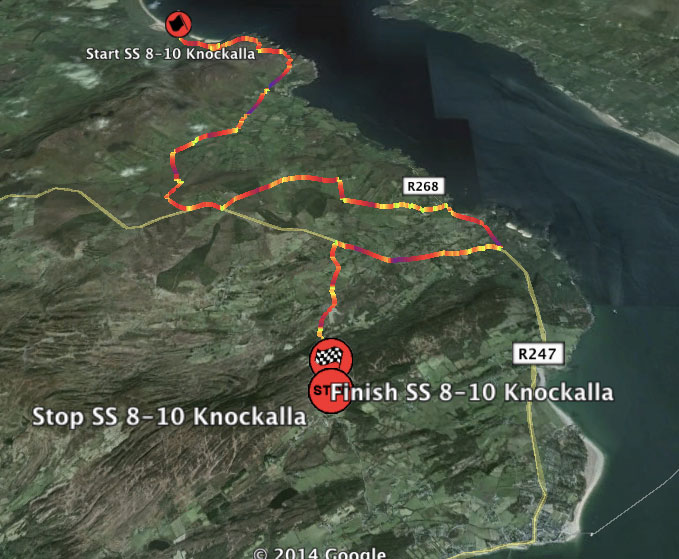
The Donegal Rally is on us once again. Over the next three days of the rally, we will post each days Google Earth Jemba Traces for your enjoyment. Day 2 is located to the north of the HQ at Letterkenny with service based at Millford. The Saturday stages are more traditional in their nature. In the morning the rally tackles two very familiar stages. Garrygort is an old classic but is still very tricky in places and then it is off to Knockalla for the sweeping coastal stage. Very fast to start with on the coast road, it then moves inland for more technical roads. The Carnhill stage is virtually a new stage, a new combination of roads, very demanding, with narrow twisty tracks but also some very fast open roads. Gartan is still a relatively young stage and enjoys some very fast flowing roads over crests and jumps mixed in with more narrow but still fast tracks. Enjoy.
Remember though. Please note that the Google Earth files are contained in a zip file. If you are using a computer, they will be downloaded to your downloads folder and can then be opened with google Earth. For mobile/iPhone/iPad users – you will be asked to “open in” an app like iFiles or Evernote etc. You must do this and then unzip the files. After this the files can be opened in Google Earth. It seems a long way around but it is worth it. It is assumed that you have installed both a file viewer & Google Earth beforehand. If not they are all available via the App Store and the Android Play Store.
You must be logged in to post a comment.